Work
 Environmental
01 · GIS & Environmental Analysis
Pepeekeo Mill Site Mapping
Multi-layer environmental context map of the historic Pepeekeo sugar mill site — flood zones, tsunami evacuation areas, stream corridors, TMK parcels, and contamination records.
QGIS
Shapefile
FEMA Flood
Tsunami Zones
3 – 4 hrs
estimated
View
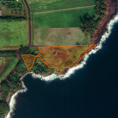
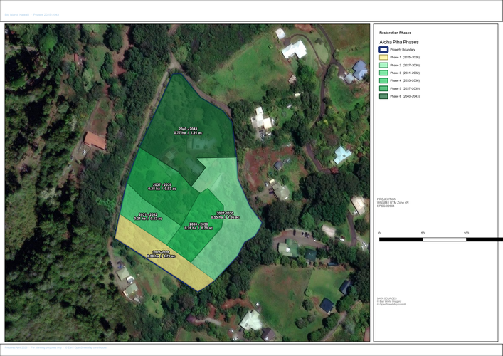 Property Mapping
02 · Boundary & Resource Mapping
Aloha Piha Mapping
Custom property boundary and resource mapping for a land parcel on Hawaiʻi Island. Delivered in KML, KMZ, shapefile, and print-ready PDF for maximum compatibility.
QGIS
KML · KMZ
Shapefile
Google Earth
1 – 2 hrs
estimated
View
Interactive Rainfall Tool
Leaflet.js · Chart.js · NOAA Data
03 · Interactive Web Application
Big Island Rainfall Comparison
Interactive tool for comparing monthly rainfall across Hawaiʻi Island between two user-selected time periods. Station data on a Leaflet map with live Chart.js charts.
Leaflet.js
Chart.js
NOAA Data
Interactive
8 – 10 hrs
estimated
Launch